Distance to and from Checotah, Oklahoma
Checotah, OK 74426
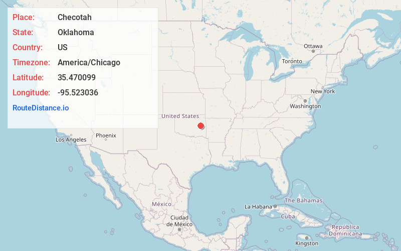
Checotah
Oklahoma
US
America/Chicago
Location Information
-
Full AddressChecotah, OK 74426
-
Coordinates35.4700993, -95.5230356
-
LocationChecotah , Oklahoma , US
-
TimezoneAmerica/Chicago
-
Current Local Time5:52:30 AM America/ChicagoSunday, May 4, 2025
-
Website
-
Page Views0
Directions to Nearest Cities
About Checotah
Checotah is a town in McIntosh County, Oklahoma, United States. It was named for Samuel Checote, the first chief of the Creek Nation elected after the Civil War. Its population was 3,481 at the 2000 census. According to Census 2010, the population has decreased to 3,335; a 4.19% loss.


Nearby Places
Found 10 places within 50 miles

Muskogee
21.0 mi
33.8 km
Muskogee, OK
Get directions

Henryetta
25.9 mi
41.7 km
Henryetta, OK 74437
Get directions

Okmulgee
26.4 mi
42.5 km
Okmulgee, OK 74447
Get directions

Fort Gibson
27.3 mi
43.9 km
Fort Gibson, OK 74434
Get directions

Coweta
34.0 mi
54.7 km
Coweta, OK
Get directions

Wagoner
34.9 mi
56.2 km
Wagoner, OK 74467
Get directions

Bixby
38.4 mi
61.8 km
Bixby, OK
Get directions

McAlester
39.6 mi
63.7 km
McAlester, OK 74501
Get directions

Sallisaw
41.4 mi
66.6 km
Sallisaw, OK 74955
Get directions

Park Hill
41.6 mi
66.9 km
Park Hill, OK
Get directions
Muskogee
21.0 mi
33.8 km
Muskogee, OK
Henryetta
25.9 mi
41.7 km
Henryetta, OK 74437
Okmulgee
26.4 mi
42.5 km
Okmulgee, OK 74447
Fort Gibson
27.3 mi
43.9 km
Fort Gibson, OK 74434
Coweta
34.0 mi
54.7 km
Coweta, OK
Wagoner
34.9 mi
56.2 km
Wagoner, OK 74467
Bixby
38.4 mi
61.8 km
Bixby, OK
McAlester
39.6 mi
63.7 km
McAlester, OK 74501
Sallisaw
41.4 mi
66.6 km
Sallisaw, OK 74955
Park Hill
41.6 mi
66.9 km
Park Hill, OK
Location Links
Local Weather
Weather Information
Coming soon!
Location Map
Static map view of Checotah, Oklahoma
Browse Places by Distance
Places within specific distances from Checotah
Short Distances
Long Distances
Click any distance to see all places within that range from Checotah. Distances shown in miles (1 mile ≈ 1.61 kilometers).