Distance to Cleveland, Georgia

Calculating Your Route
Just a moment while we process your request...
Location Information
-
Full AddressCleveland, GA 30528
-
Coordinates34.5970402, -83.7632366
-
LocationCleveland , Georgia , US
-
TimezoneAmerica/New_York
-
Current Local Time5:29:47 AM America/New_YorkWednesday, June 18, 2025
-
Page Views0
About Cleveland
Cleveland is a city in White County, Georgia, located 90 miles northeast of Atlanta and 128 miles southeast of Chattanooga, Tennessee. Its population was 3,514 at the 2020 census. It is the county seat of White County.


Nearby Places
Found 10 places within 50 miles

Dahlonega
13.5 mi
21.7 km
Dahlonega, GA 30533
Get directions

Cornelia
14.7 mi
23.7 km
Cornelia, GA
Get directions

Baldwin
14.8 mi
23.8 km
Baldwin, GA
Get directions

Gainesville
21.0 mi
33.8 km
Gainesville, GA
Get directions

Dawsonville
23.6 mi
38.0 km
Dawsonville, GA 30534
Get directions

Toccoa
24.5 mi
39.4 km
Toccoa, GA
Get directions

Oakwood
26.4 mi
42.5 km
Oakwood, GA
Get directions

Flowery Branch
29.9 mi
48.1 km
Flowery Branch, GA
Get directions

Commerce
32.3 mi
52.0 km
Commerce, GA
Get directions

Braselton
33.7 mi
54.2 km
Braselton, GA
Get directions
Location Links
Local Weather
Weather Information
Coming soon!
Location Map
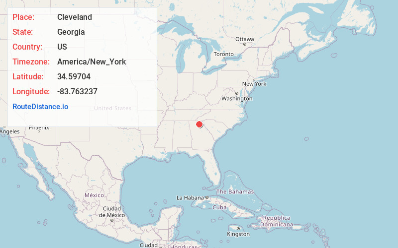
Static map view of Cleveland, Georgia
Browse Places by Distance
Places within specific distances from Cleveland
Short Distances
Long Distances
Click any distance to see all places within that range from Cleveland. Distances shown in miles (1 mile ≈ 1.61 kilometers).