Distance to Hogetown, North Carolina

Calculating Your Route
Just a moment while we process your request...
Location Information
-
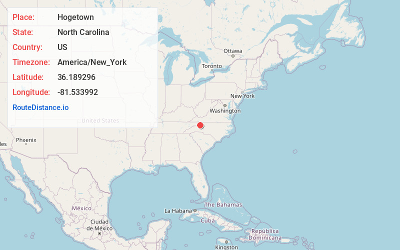
Full AddressHogetown, NC 28618
-
Coordinates36.1892957, -81.5339915
-
LocationNorth Carolina , US
-
TimezoneAmerica/New_York
-
Current Local Time1:55:37 AM America/New_YorkWednesday, June 18, 2025
-
Page Views0
Nearby Places
Found 10 places within 50 miles

Rutherwood
4.4 mi
7.1 km
Rutherwood, NC 28607
Get directions
Aho
5.0 mi
8.0 km
Aho, NC 28607
Get directions
Mt Zion
5.5 mi
8.9 km
Mt Zion, NC 28624
Get directions
Brownwood
6.2 mi
10.0 km
Brownwood, NC 28684
Get directions
Harley
6.7 mi
10.8 km
Harley, NC 28665
Get directions
Yates
8.1 mi
13.0 km
Yates, NC 28626
Get directions

Fleetwood
8.2 mi
13.2 km
Fleetwood, NC 28626
Get directions
Soda Hill
8.3 mi
13.4 km
Soda Hill, NC 28607
Get directions

Boone
8.5 mi
13.7 km
Boone, NC
Get directions
Bailey Camp
8.6 mi
13.8 km
Bailey Camp, NC 28645
Get directions
Location Links
Local Weather
Weather Information
Coming soon!
Location Map
Static map view of Hogetown, North Carolina
Browse Places by Distance
Places within specific distances from Hogetown
Short Distances
Long Distances
Click any distance to see all places within that range from Hogetown. Distances shown in miles (1 mile ≈ 1.61 kilometers).