Distance to Loudonville, Ohio

Calculating Your Route
Just a moment while we process your request...
Location Information
-
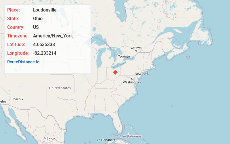
Full AddressLoudonville, OH 44842
-
Coordinates40.6353382, -82.2332144
-
LocationLoudonville , Ohio , US
-
TimezoneAmerica/New_York
-
Current Local Time5:51:04 AM America/New_YorkThursday, June 5, 2025
-
Page Views0
About Loudonville
Loudonville is a village in Ashland and Holmes counties in the U.S. state of Ohio. The population was 2,786 at the 2020 census. Loudonville is nicknamed the "Canoe Capital of Ohio" for the many canoe liveries along the Mohican River. It is also home to Mohican State Park and Mohican-Memorial State Forest.


Nearby Places
Found 10 places within 50 miles

Ashland
16.7 mi
26.9 km
Ashland, OH 44805
Get directions

Mansfield
17.0 mi
27.4 km
Mansfield, OH
Get directions

Millersburg
17.5 mi
28.2 km
Millersburg, OH 44654
Get directions

Lexington
18.5 mi
29.8 km
Lexington, OH 44904
Get directions

Wooster
19.0 mi
30.6 km
Wooster, OH 44691
Get directions

Ontario
20.6 mi
33.2 km
Ontario, OH
Get directions

Mt Vernon
21.3 mi
34.3 km
Mt Vernon, OH 43050
Get directions

Shelby
28.2 mi
45.4 km
Shelby, OH 44875
Get directions

Crestline
28.4 mi
45.7 km
Crestline, OH
Get directions

Orrville
28.5 mi
45.9 km
Orrville, OH 44667
Get directions
Location Links
Local Weather
Weather Information
Coming soon!
Location Map
Static map view of Loudonville, Ohio
Browse Places by Distance
Places within specific distances from Loudonville
Short Distances
Long Distances
Click any distance to see all places within that range from Loudonville. Distances shown in miles (1 mile ≈ 1.61 kilometers).