Distance to Manitou Junction, Minnesota

Calculating Your Route
Just a moment while we process your request...
Location Information
-
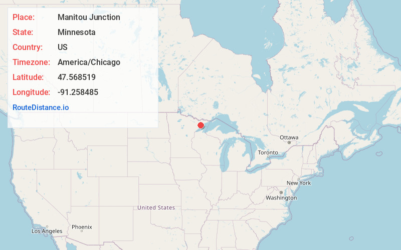
Full AddressManitou Junction, MN 55603
-
Coordinates47.5685187, -91.2584851
-
LocationManitou Junction , Minnesota , US
-
TimezoneAmerica/Chicago
-
Current Local Time1:42:18 AM America/ChicagoFriday, June 20, 2025
-
Page Views0
Nearby Places
Found 10 places within 50 miles

Baptism Crossing
4.7 mi
7.6 km
Baptism Crossing, MN 55603
Get directions
Murphy City
5.1 mi
8.2 km
Murphy City, MN 55603
Get directions

Isabella
5.6 mi
9.0 km
Isabella, MN 55607
Get directions
Kelly Landing
8.3 mi
13.4 km
Kelly Landing, MN 55607
Get directions

Cramer
8.4 mi
13.5 km
Cramer, MN 55603
Get directions
Maple
9.1 mi
14.6 km
Maple, MN 55603
Get directions

Lake No. 1
9.8 mi
15.8 km
Lake No. 1, MN
Get directions

Sawbill Landing
10.1 mi
16.3 km
Sawbill Landing, MN 55607
Get directions
Jay See Landing
10.4 mi
16.7 km
Jay See Landing, MN 55607
Get directions

Stony River Township
10.4 mi
16.7 km
Stony River Township, MN
Get directions
Location Links
Local Weather
Weather Information
Coming soon!
Location Map
Static map view of Manitou Junction, Minnesota
Browse Places by Distance
Places within specific distances from Manitou Junction
Short Distances
Long Distances
Click any distance to see all places within that range from Manitou Junction. Distances shown in miles (1 mile ≈ 1.61 kilometers).