Distance to Nickleville, Georgia

Calculating Your Route
Just a moment while we process your request...
Location Information
-
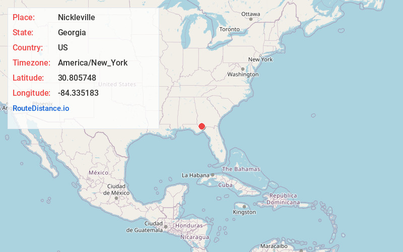
Full AddressNickleville, GA 39897
-
Coordinates30.8057479, -84.3351831
-
LocationGeorgia , US
-
TimezoneAmerica/New_York
-
Current Local Time1:25:10 PM America/New_YorkTuesday, June 3, 2025
-
Page Views0
Nearby Places
Found 10 places within 50 miles

Whigham
5.4 mi
8.7 km
Whigham, GA 39897
Get directions

Calvary
5.5 mi
8.9 km
Calvary, GA
Get directions

Climax
7.5 mi
12.1 km
Climax, GA 39834
Get directions
Darsey
8.6 mi
13.8 km
Darsey, FL 32333
Get directions

Cairo
9.4 mi
15.1 km
Cairo, GA
Get directions
Attapulgus
9.7 mi
15.6 km
Attapulgus, GA 39815
Get directions
Brownlee
10.6 mi
17.1 km
Brownlee, Cairo, GA 39828
Get directions
Dogtown
13.3 mi
21.4 km
Dogtown, FL 32352
Get directions
Moncrief
13.4 mi
21.6 km
Moncrief, GA 31792
Get directions

Havana
13.4 mi
21.6 km
Havana, FL 32333
Get directions
Location Links
Local Weather
Weather Information
Coming soon!
Location Map
Static map view of Nickleville, Georgia
Browse Places by Distance
Places within specific distances from Nickleville
Short Distances
Long Distances
Click any distance to see all places within that range from Nickleville. Distances shown in miles (1 mile ≈ 1.61 kilometers).