Distance to Palmyra, Virginia

Calculating Your Route
Just a moment while we process your request...
Location Information
-
Full AddressPalmyra, VA 22963
-
Coordinates37.8609872, -78.2633426
-
LocationPalmyra , Virginia , US
-
TimezoneAmerica/New_York
-
Current Local Time6:32:40 PM America/New_YorkFriday, June 20, 2025
-
Page Views0
About Palmyra
Palmyra is a census-designated place in and the county seat of Fluvanna County, Virginia, United States. The population as of the 2010 census was 104. Palmyra lies on the eastern bank of the Rivanna River along U.S. Route 15. The ZIP code for Palmyra and surrounding rural land is 22963.


Nearby Places
Found 10 places within 50 miles

Lake Monticello
5.1 mi
8.2 km
Lake Monticello, VA 22963
Get directions

Rivanna
11.3 mi
18.2 km
Rivanna, VA 22947
Get directions

Keswick
11.7 mi
18.8 km
Keswick, VA 22947
Get directions

Scottsville
13.4 mi
21.6 km
Scottsville, VA 24590
Get directions

Pantops
15.0 mi
24.1 km
Pantops, VA
Get directions

Charlottesville
16.5 mi
26.6 km
Charlottesville, VA
Get directions

University of Virginia
17.9 mi
28.8 km
University of Virginia, Charlottesville, VA
Get directions

Louisa
18.1 mi
29.1 km
Louisa, VA 23093
Get directions

Esmont
18.9 mi
30.4 km
Esmont, VA 22937
Get directions
Rio
19.1 mi
30.7 km
Rio, VA 22901
Get directions
Location Links
Local Weather
Weather Information
Coming soon!
Location Map
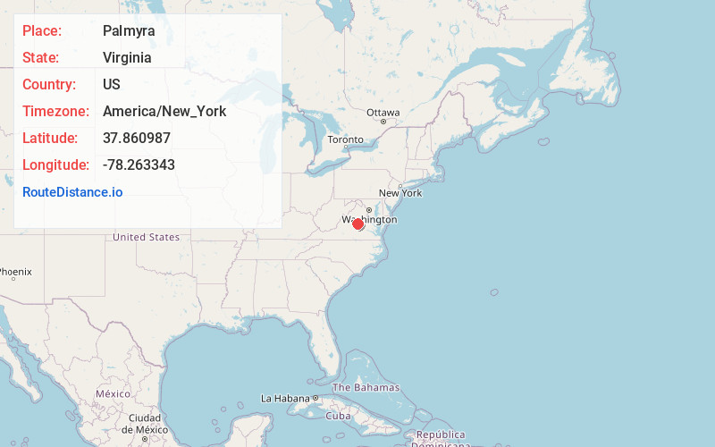
Static map view of Palmyra, Virginia
Browse Places by Distance
Places within specific distances from Palmyra
Short Distances
Long Distances
Click any distance to see all places within that range from Palmyra. Distances shown in miles (1 mile ≈ 1.61 kilometers).