Distance to Uniontown, Kentucky

Calculating Your Route
Just a moment while we process your request...
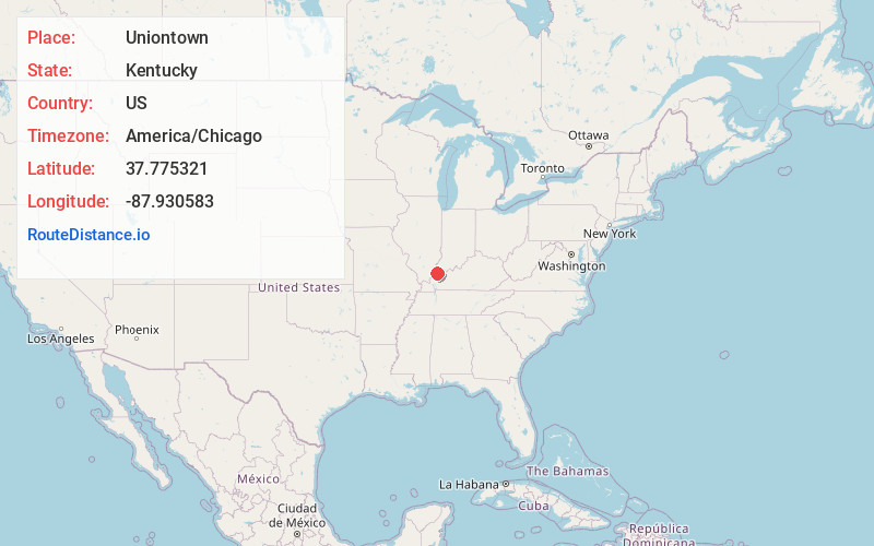
Location Information
-
Full AddressUniontown, KY 42461
-
Coordinates37.7753214, -87.9305827
-
LocationUniontown , Kentucky , US
-
TimezoneAmerica/Chicago
-
Current Local Time2:43:12 AM America/ChicagoSunday, June 22, 2025
-
Page Views0
About Uniontown
Uniontown is a home rule-class city in Union County, Kentucky, United States. The population was 929 at the 2020 census. The John T. Myers Locks and Dam, once known as Uniontown Locks and Dam, is located downriver 3½ miles.


Nearby Places
Found 10 places within 50 miles

Morganfield
6.4 mi
10.3 km
Morganfield, KY 42437
Get directions

Mt Vernon
11.0 mi
17.7 km
Mt Vernon, IN 47620
Get directions

Corydon
12.6 mi
20.3 km
Corydon, KY 42406
Get directions

Shawneetown
14.6 mi
23.5 km
Shawneetown, IL 62984
Get directions

Sturgis
16.1 mi
25.9 km
Sturgis, KY 42459
Get directions

Ridgway
18.1 mi
29.1 km
Ridgway, IL 62979
Get directions

Henderson
19.2 mi
30.9 km
Henderson, KY 42420
Get directions

Clay
21.5 mi
34.6 km
Clay, KY 42404
Get directions

Dixon
22.1 mi
35.6 km
Dixon, KY 42409
Get directions

Evansville
23.8 mi
38.3 km
Evansville, IN
Get directions
Location Links
Local Weather
Weather Information
Coming soon!
Location Map
Static map view of Uniontown, Kentucky
Browse Places by Distance
Places within specific distances from Uniontown
Short Distances
Long Distances
Click any distance to see all places within that range from Uniontown. Distances shown in miles (1 mile ≈ 1.61 kilometers).