Distance to Wyaconda, Missouri

Calculating Your Route
Just a moment while we process your request...
Location Information
-
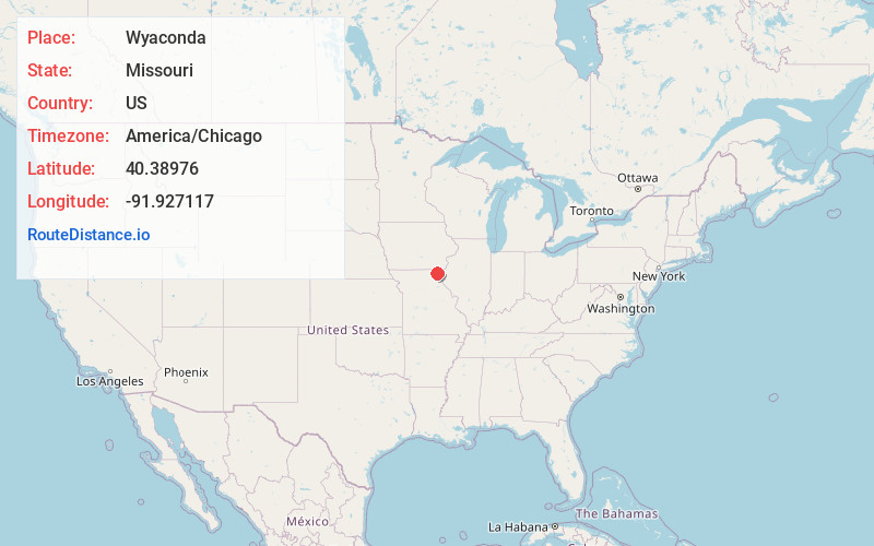
Full AddressWyaconda, MO 63474
-
Coordinates40.3897603, -91.9271167
-
LocationWyaconda , Missouri , US
-
TimezoneAmerica/Chicago
-
Current Local Time7:24:50 PM America/ChicagoWednesday, May 21, 2025
-
Page Views0
About Wyaconda
Wyaconda is a city in Clark County, Missouri, United States. As of the 2020 census, its population was 214. The city was organized in 1888 and is named after a Siouan name for God or the Great Spirit. The first land purchased from the Santa Fe and Land Co. was in 1888.


Nearby Places
Found 10 places within 50 miles

Medill
8.5 mi
13.7 km
Medill, MO 63445
Get directions

Kahoka
11.1 mi
17.9 km
Kahoka, MO 63445
Get directions

Memphis
13.7 mi
22.0 km
Memphis, MO 63555
Get directions

Wayland
18.1 mi
29.1 km
Wayland, MO 63472
Get directions
La Belle
18.9 mi
30.4 km
La Belle, MO 63447
Get directions

Cantril
19.1 mi
30.7 km
Cantril, IA 52542
Get directions
St Francisville
19.4 mi
31.2 km
St Francisville, MO 63472
Get directions
Farmington
19.8 mi
31.9 km
Farmington, IA 52626
Get directions

Edina
20.1 mi
32.3 km
Edina, MO 63537
Get directions
Lewistown
21.8 mi
35.1 km
Lewistown, MO 63452
Get directions
Location Links
Local Weather
Weather Information
Coming soon!
Location Map
Static map view of Wyaconda, Missouri
Browse Places by Distance
Places within specific distances from Wyaconda
Short Distances
Long Distances
Click any distance to see all places within that range from Wyaconda. Distances shown in miles (1 mile ≈ 1.61 kilometers).