Distance to Fogel, Arkansas

Calculating Your Route
Just a moment while we process your request...
Location Information
-
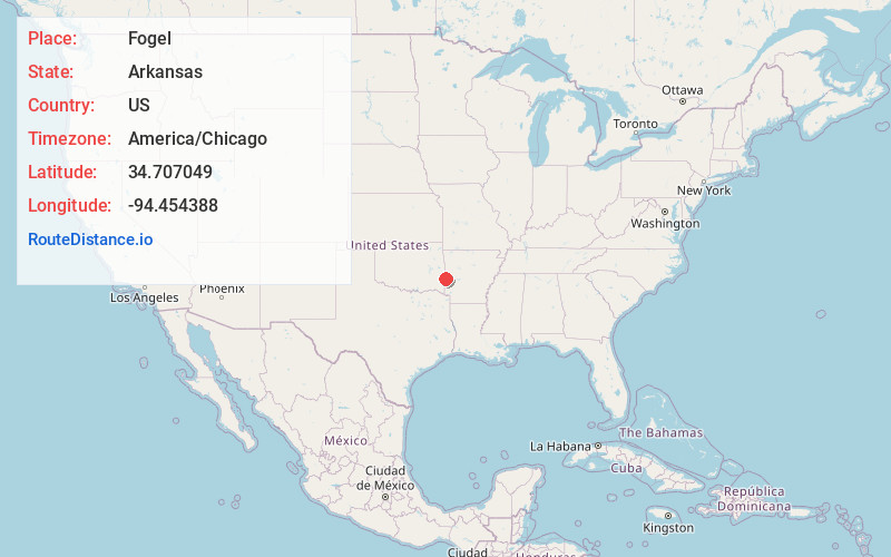
Full AddressFogel, AR 71953
-
Coordinates34.7070486, -94.4543877
-
LocationArkansas , US
-
TimezoneAmerica/Chicago
-
Current Local Time6:37:26 PM America/ChicagoMonday, May 19, 2025
-
Page Views0
Nearby Places
Found 10 places within 50 miles

Fogel
0.1 mi
0.2 km
Fogel, OK 74937
Get directions
Self Mountain
2.3 mi
3.7 km
Self Mountain, Arkansas 71953
Get directions
Black Fork
4.4 mi
7.1 km
Black Fork, AR 71953
Get directions
Haw Creek
5.5 mi
8.9 km
Haw Creek, OK 74937
Get directions
Puryear
6.0 mi
9.7 km
Puryear, AR 71953
Get directions

Rich Mountain
6.8 mi
10.9 km
Rich Mountain, AR 71953
Get directions

Eagleton
9.0 mi
14.5 km
Eagleton, AR 71953
Get directions
Rocky
9.3 mi
15.0 km
Rocky, AR 71953
Get directions
Stapp
10.2 mi
16.4 km
Stapp, OK 74937
Get directions
Zoe
10.7 mi
17.2 km
Zoe, OK 74939
Get directions
Location Links
Local Weather
Weather Information
Coming soon!
Location Map
Static map view of Fogel, Arkansas
Browse Places by Distance
Places within specific distances from Fogel
Short Distances
Long Distances
Click any distance to see all places within that range from Fogel. Distances shown in miles (1 mile ≈ 1.61 kilometers).