Distance to Jersey, Georgia

Calculating Your Route
Just a moment while we process your request...
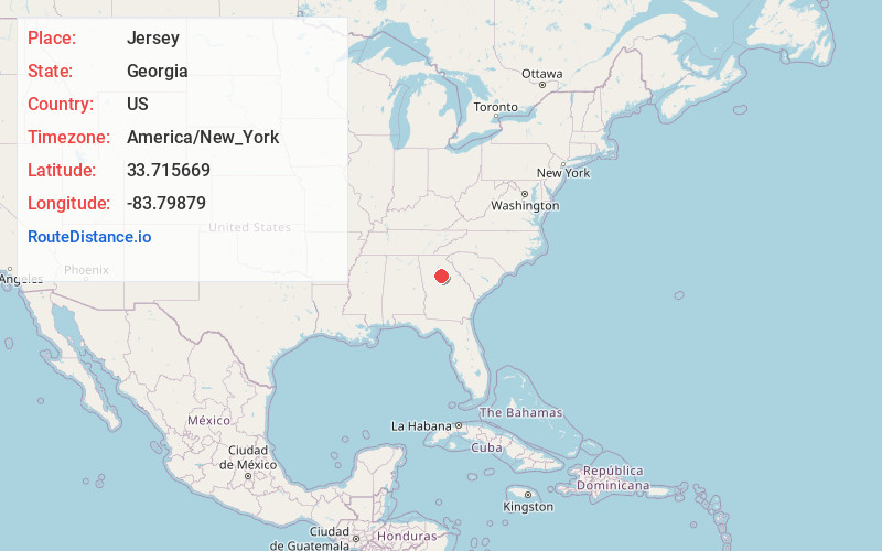
Location Information
-
Full AddressJersey, GA
-
Coordinates33.7156693, -83.7987901
-
LocationJersey , Georgia , US
-
TimezoneAmerica/New_York
-
Current Local Time9:24:16 PM America/New_YorkFriday, June 20, 2025
-
Page Views0
About Jersey
Jersey is a town in Walton County, Georgia, United States. The population was 146 at the 2020 census.


Nearby Places
Found 10 places within 50 miles

Walnut Grove
3.6 mi
5.8 km
Walnut Grove, GA
Get directions

Social Circle
6.2 mi
10.0 km
Social Circle, GA 30025
Get directions

Between
7.1 mi
11.4 km
Between, GA
Get directions

Monroe
7.4 mi
11.9 km
Monroe, GA
Get directions
Oxford
7.8 mi
12.6 km
Oxford, GA 30054
Get directions

Covington
8.9 mi
14.3 km
Covington, GA
Get directions

Loganville
10.3 mi
16.6 km
Loganville, GA 30052
Get directions

Porterdale
11.1 mi
17.9 km
Porterdale, GA
Get directions
Fairview
11.3 mi
18.2 km
Fairview, GA 30016
Get directions

Good Hope
11.9 mi
19.2 km
Good Hope, GA 30641
Get directions
Location Links
Local Weather
Weather Information
Coming soon!
Location Map
Static map view of Jersey, Georgia
Browse Places by Distance
Places within specific distances from Jersey
Short Distances
Long Distances
Click any distance to see all places within that range from Jersey. Distances shown in miles (1 mile ≈ 1.61 kilometers).