Distance to Ladysmith, Kansas

Calculating Your Route
Just a moment while we process your request...
Location Information
-
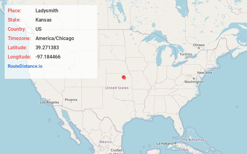
Full AddressLadysmith, Exeter Township, KS 67432
-
Coordinates39.2713832, -97.1844655
-
LocationExeter Township , Kansas , US
-
TimezoneAmerica/Chicago
-
Current Local Time3:43:09 AM America/ChicagoThursday, July 3, 2025
-
Page Views0
About Ladysmith
Ladysmith is an unincorporated community in Clay County, Kansas, United States. It is located approximately 6.5 miles southwest of Clay Center along Kiowa Rd.
Nearby Places
Found 10 places within 50 miles

Clay Center
8.0 mi
12.9 km
Clay Center, KS 67432
Get directions

Oak Hill
8.6 mi
13.8 km
Oak Hill, KS 67432
Get directions
Industry
9.6 mi
15.4 km
Industry, KS 67410
Get directions

Wakefield
9.9 mi
15.9 km
Wakefield, KS 67487
Get directions

Longford
10.5 mi
16.9 km
Longford, KS 67458
Get directions
Browndale
10.8 mi
17.4 km
Browndale, Five Creeks Township, KS 67432
Get directions

Bala
12.8 mi
20.6 km
Bala, KS 66531
Get directions
Morganville
13.5 mi
21.7 km
Morganville, KS 67468
Get directions

Manchester
14.4 mi
23.2 km
Manchester, KS 67410
Get directions
Green
14.6 mi
23.5 km
Green, KS 67447
Get directions
Location Links
Local Weather
Weather Information
Coming soon!
Location Map
Static map view of Ladysmith, Kansas
Browse Places by Distance
Places within specific distances from Ladysmith
Short Distances
Long Distances
Click any distance to see all places within that range from Ladysmith. Distances shown in miles (1 mile ≈ 1.61 kilometers).