Distance to Clark County, Ohio

Calculating Your Route
Just a moment while we process your request...
Location Information
-
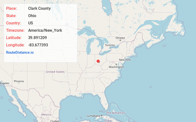
Full AddressClark County, OH
-
Coordinates39.8912092, -83.6773928
-
LocationOhio , US
-
TimezoneAmerica/New_York
-
Current Local Time10:05:55 PM America/New_YorkTuesday, July 1, 2025
-
Page Views0
About Clark County
Clark County is a county located in the west central portion of the U.S. state of Ohio. As of the 2020 census, the population was 136,001. Its county seat and largest city is Springfield. The county was created on March 1, 1818, and was named for General George Rogers Clark, a hero of the American Revolution.


Nearby Places
Found 10 places within 50 miles

Harmony
2.4 mi
3.9 km
Harmony, OH 45505
Get directions
Dolly Varden
3.5 mi
5.6 km
Dolly Varden, Madison Township, OH 45368
Get directions

South Vienna
4.2 mi
6.8 km
South Vienna, OH 45369
Get directions
South Charleston
5.1 mi
8.2 km
South Charleston, OH 45368
Get directions
Villa
6.7 mi
10.8 km
Villa, OH 45503
Get directions
Cortsville
6.9 mi
11.1 km
Cortsville, Green Township, OH 45368
Get directions

Springfield
7.4 mi
11.9 km
Springfield, OH
Get directions
Selma
7.4 mi
11.9 km
Selma, OH 45368
Get directions

Catawba
8.0 mi
12.9 km
Catawba, OH
Get directions
Moorefield Township
8.1 mi
13.0 km
Moorefield Township, OH
Get directions
Location Links
Local Weather
Weather Information
Coming soon!
Location Map
Static map view of Clark County, Ohio
Browse Places by Distance
Places within specific distances from Clark County
Short Distances
Long Distances
Click any distance to see all places within that range from Clark County. Distances shown in miles (1 mile ≈ 1.61 kilometers).