Distance to Paskenta, California

Calculating Your Route
Just a moment while we process your request...
Location Information
-
Full AddressPaskenta, CA 96074
-
Coordinates39.8845702, -122.5464131
-
LocationPaskenta , California , US
-
TimezoneAmerica/Los_Angeles
-
Current Local Time11:31:51 PM America/Los_AngelesSunday, June 22, 2025
-
Page Views0
About Paskenta
Paskenta is a small unincorporated town in Tehama County, California. Historically, it had greater local importance due to the presence of an active lumber mill. The ZIP Code is 96074. The community is inside area code 530 and the Paskenta CDP. Paskenta sits at an elevation of 725 feet.


Nearby Places
Found 10 places within 50 miles

Flournoy
5.8 mi
9.3 km
Flournoy, CA
Get directions

Rancho Tehama Reserve
9.3 mi
15.0 km
Rancho Tehama Reserve, CA
Get directions

Corning
19.7 mi
31.7 km
Corning, CA 96021
Get directions

Richfield
20.5 mi
33.0 km
Richfield, CA 96021
Get directions

Orland
20.9 mi
33.6 km
Orland, CA 95963
Get directions

Proberta
24.1 mi
38.8 km
Proberta, CA
Get directions

Gerber
24.2 mi
38.9 km
Gerber, CA 96035
Get directions

Tehama
24.5 mi
39.4 km
Tehama, CA
Get directions

Los Molinos
25.4 mi
40.9 km
Los Molinos, CA 96055
Get directions

Artois
25.9 mi
41.7 km
Artois, CA
Get directions
Location Links
Local Weather
Weather Information
Coming soon!
Location Map
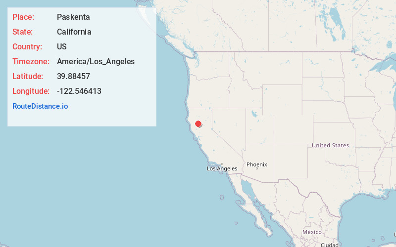
Static map view of Paskenta, California
Browse Places by Distance
Places within specific distances from Paskenta
Short Distances
Long Distances
Click any distance to see all places within that range from Paskenta. Distances shown in miles (1 mile ≈ 1.61 kilometers).