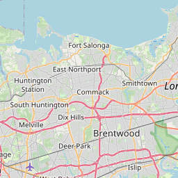
Cities within 40 miles of Riverhead
267 places found
 20.5 miles
Dering Harbor
New York
US
41.0929, -72.3468
20.4 miles
Falkner Island
Connecticut
US
41.2125, -72.6537
20.3 miles
East Patchogue
New York
US
40.7670, -72.9962
20.2 miles
Port Jefferson Station
New York
US
40.9254, -73.0473
20.1 miles
Farmingville
New York
US
40.8312, -73.0296
20.1 miles
Sag Harbor
New York
US
40.9979, -72.2926
20.1 miles
Sagaponack
New York
US
40.9254, -72.2781
20.1 miles
Crystal Brook Hollow
New York
US
40.9533, -73.0431
19.9 miles
Shelter Island
New York
US
41.0682, -72.3387
North Haven
New York
US
41.0129, -72.3129
19.3 miles
Mt Sinai
New York
US
40.9470, -73.0296
19.0 miles
Medford
New York
US
40.8176, -73.0001
19.0 miles
Bridgehampton
New York
US
40.9379, -72.3009
Montclair Colony
New York
US
41.0509, -72.3493
Hagerman
New York
US
40.7707, -72.9640
18.2 miles
Bellport
New York
US
40.7570, -72.9393
17.7 miles
Miller Place
New York
US
40.9598, -72.9962
North Bellport
New York
US
40.7743, -72.9429
17.6 miles
Noyack
New York
US
40.9957, -72.3412
West Mecox Village
New York
US
40.9173, -72.3281
Hayground Cove
New York
US
40.9137, -72.3363
Scuttlehole
New York
US
40.9354, -72.3401
 16.8 miles
Fireplace Neck Tidal Wetlands Area
New York
US
40.7612, -72.9091
Gordon Heights
New York
US
40.8587, -72.9703


Leaflet © OpenStreetMap contributors