Distance to Allah, Arizona

Calculating Your Route
Just a moment while we process your request...
Location Information
-
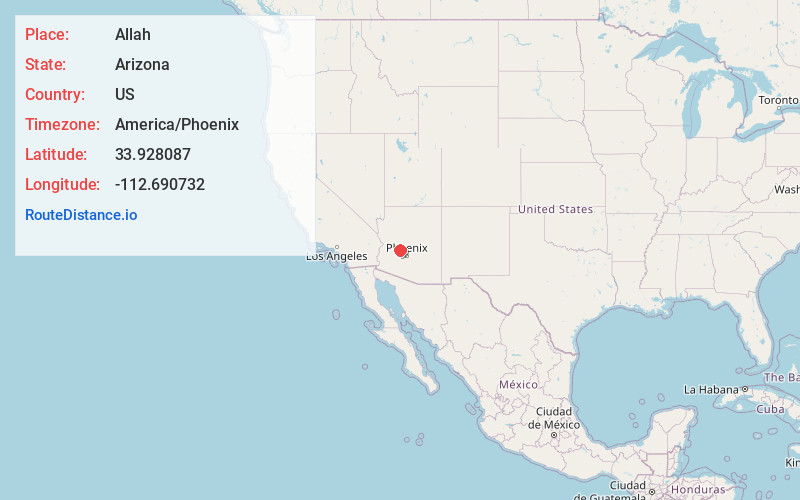
Full AddressAllah, AZ 85390
-
Coordinates33.9280866, -112.6907319
-
LocationAllah , Arizona , US
-
TimezoneAmerica/Phoenix
-
Current Local Time3:56:40 PM America/PhoenixTuesday, June 17, 2025
-
Page Views0
About Allah
Allah is a populated place located in Maricopa County, Arizona.
Nearby Places
Found 10 places within 50 miles

Wickenburg
3.7 mi
6.0 km
Wickenburg, AZ 85390
Get directions

Morristown
6.5 mi
10.5 km
Morristown, AZ
Get directions

Wittmann
14.0 mi
22.5 km
Wittmann, AZ 85361
Get directions

Octave
14.8 mi
23.8 km
Octave, AZ 85332
Get directions

Copperopolis Mine
16.7 mi
26.9 km
Copperopolis Mine, Arizona 85342
Get directions
Lehman Mill
17.5 mi
28.2 km
Lehman Mill, AZ 85342
Get directions

Congress
18.6 mi
29.9 km
Congress, AZ 85332
Get directions

Yarnell
20.5 mi
33.0 km
Yarnell, AZ
Get directions
Wagoner
21.6 mi
34.8 km
Wagoner, AZ 86332
Get directions
Forepaugh Peak
22.1 mi
35.6 km
Forepaugh Peak, Arizona 85390
Get directions
Location Links
Local Weather
Weather Information
Coming soon!
Location Map
Static map view of Allah, Arizona
Browse Places by Distance
Places within specific distances from Allah
Short Distances
Long Distances
Click any distance to see all places within that range from Allah. Distances shown in miles (1 mile ≈ 1.61 kilometers).